Strategic crossings remove missing links that have long interrupted key transport routes
ACROSS Sarawak, roads have long had to contend with a geography carved by major rivers.
A route may stretch towards the next town, settlement or economic centre, only to stop at the riverbank.
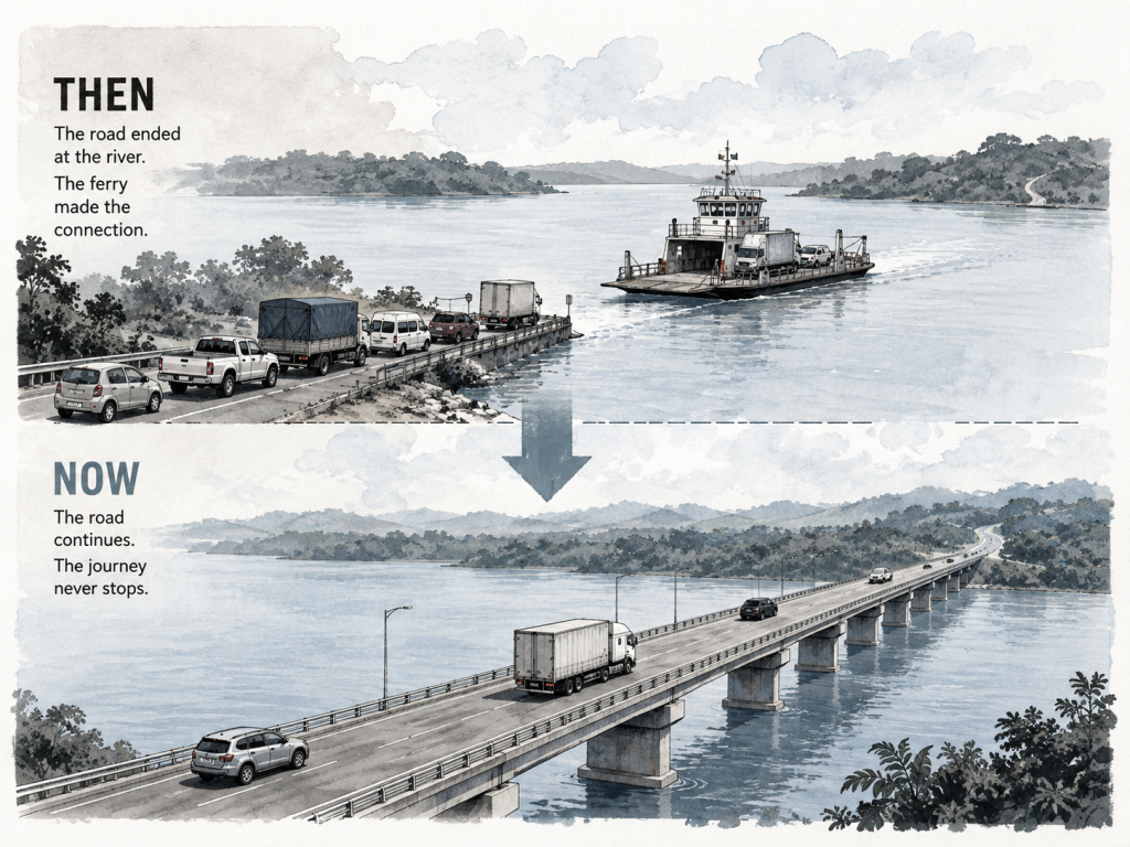
For years, ferries filled that gap. Vehicles would leave the road, cross the river by ferry and resume their journey on the opposite bank.
For Sebuyau resident Usah Jakir, that interruption could mean anything from a routine wait to several hours beside the river.
“Before this, we had to wait for the ferry to cross the river, which took a long time whenever there was a long queue of cars.
“Our travel also depended on the ferry’s schedule which was sometimes affected by the tide.
“When I was travelling back from Bintulu once, I had to wait a few hours before the ferry could take off because of a king tide,” he told Sarawak Tribune.
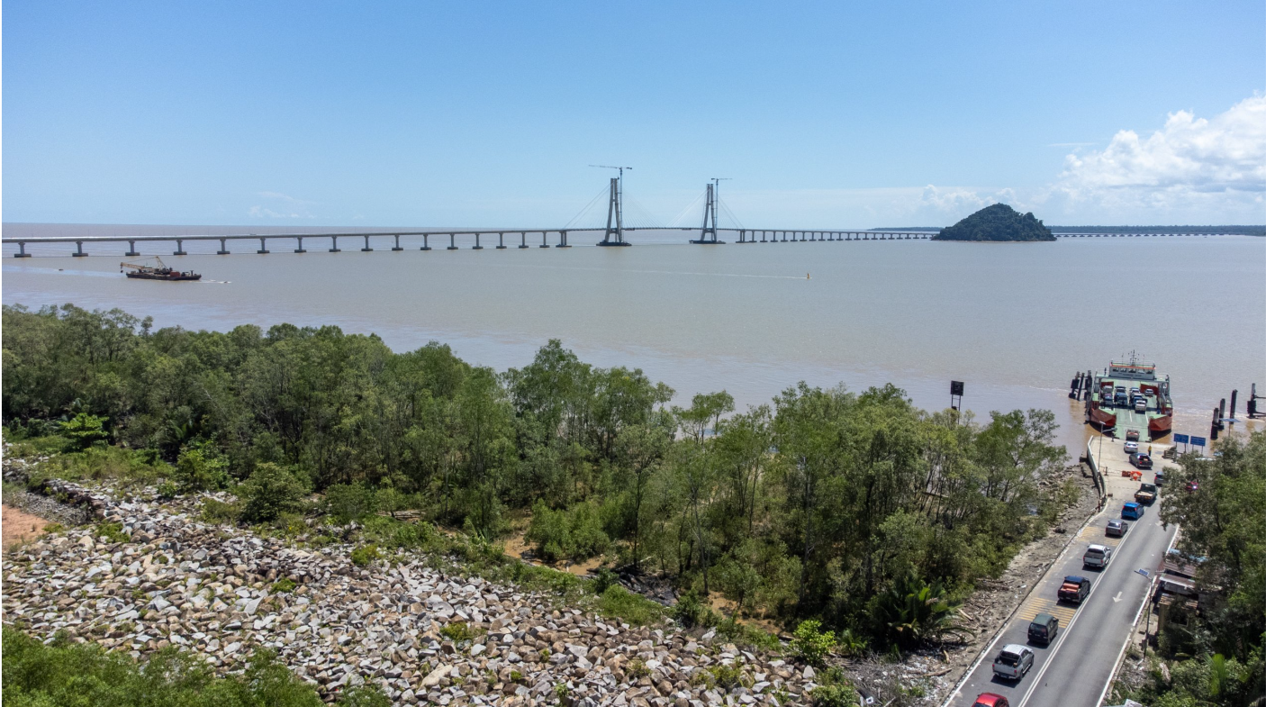
Since the Batang Lupar 1 Bridge opened to traffic on May 21, that part of his journey no longer depends on a ferry.
The river remains where it has always been. What has changed is whether the road journey has to stop for it.
When the road reaches the river
That difference lies at the centre of Sarawak’s major bridge programme.
Public Works Department (PWD) Sarawak senior civil engineer Aqmarol Rosli said one of the main infrastructure gaps being addressed is the lack of continuous land connectivity across the state’s many major rivers.
“From PWD’s perspective, the main infrastructure gap that Sarawak is addressing is the lack of continuous land connectivity across its many major rivers.
“Although Sarawak has an extensive road network, several key routes have historically been interrupted by river crossings that rely on ferry services.
“While these ferries have served communities well over the years, they also create bottlenecks that affect travel time, reliability, the movement of people and goods, and access to essential services,” he told Sarawak Tribune.
The distinction changes how a bridge is understood.
Viewed on its own, a bridge joins two riverbanks. Viewed as part of a road system, it connects sections of a route that would otherwise remain separated by water.
Aqmarol described those interruptions as “missing links”.
“The strategic construction of these major bridges is intended to address these missing links with permanent bridges, creating a seamless road network that connects communities across the state,” he said.
Closing those gaps, he added, can have consequences beyond transport.
“Better connectivity also provides the foundation for extending public infrastructure such as treated water supply, electricity, telecommunications, healthcare, and education services to areas that were previously less accessible.”
But the existence of a ferry crossing does not automatically make a bridge necessary.
When does a ferry become a bridge?
The decision, Aqmarol said, begins much further upstream in the planning process.
“The decision to replace a ferry crossing with a permanent bridge is guided by long-term planning rather than a single factor.
“It begins with the State’s development master plans and policies, which identify future growth centres, industrial areas, population expansion, and socio-economic corridors.”
Once those areas are identified, transport planners determine the road alignments needed to support future connectivity.
If a proposed route encounters a ferry crossing, the case for a permanent bridge is then assessed.
“A range of technical and operational indicators are then considered.
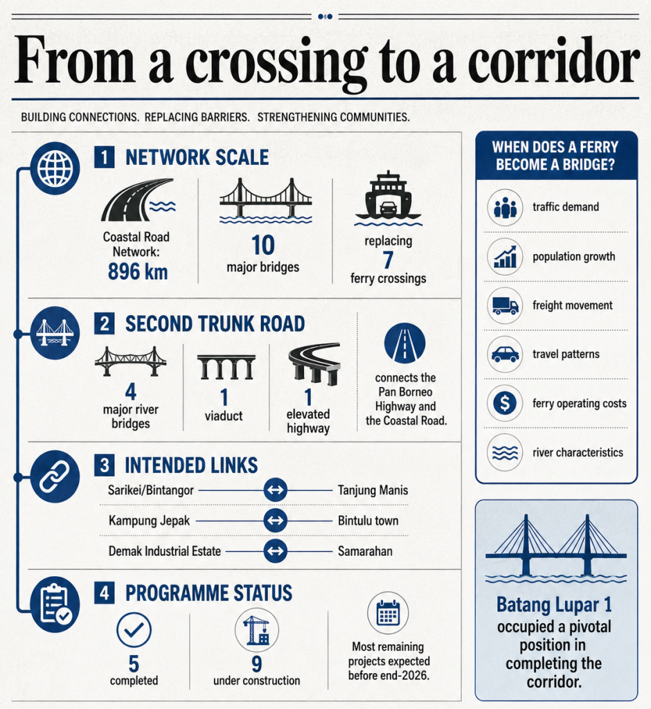
“These include current and projected traffic demand, population growth, freight movement, travel patterns, ferry operating costs, and the long-term economic benefits of providing uninterrupted road access.”
The river itself also matters.
Aqmarol said wider crossings with strong currents and high passenger demand generally require larger ferries, increasing operating costs, diesel consumption and carbon emissions over time.
“Such crossings are generally given higher priority for bridge construction when funding becomes available.
“That said, ferry services continue to play a role in Sarawak’s transport network.
“They remain a practical and effective means of connecting communities separated by rivers, particularly in areas where traffic demand has yet to warrant investment in a permanent bridge or where development is still emerging.”
That means Sarawak’s shift towards permanent crossings is not a blanket replacement of every ferry.
In areas where demand remains relatively low, ferries can continue serving communities while allowing transport capacity to change as those areas develop.
“As population, economic activities, and traffic demand increase over time, these crossings can then be reassessed to determine whether a permanent bridge would deliver greater long-term value,” Aqmarol said.
From a crossing to a corridor
The wider purpose becomes clearer when the bridges are considered collectively rather than individually.
Aqmarol said completed bridges form the links needed for the Coastal Road Network and Second Trunk Road to operate as continuous corridors.
“The completed bridges are the critical links that enable both the Coastal Road Network and the Second Trunk Road to function as intended, providing continuous transport corridors across Sarawak.
“While the road sections establish the alignment of each network, the bridges connect segments separated by major rivers and challenging terrain, transforming previously disconnected routes into seamless road connections.”
The Coastal Road Network stretches approximately 896 kilometres along Sarawak’s coastline and comprises 10 major bridges across major rivers, replacing seven ferry crossings.
The Second Trunk Road complements it with four major river bridges, one viaduct and one elevated highway, providing connections between the Pan Borneo Highway and the Coastal Road.
Among the connections the Coastal Road Network is intended to establish are continuous links between Sarikei/Bintangor and Tanjung Manis, Kampung Jepak and Bintulu town, and the Demak Industrial Estate and Samarahan.
“Together, these strategic links improve the movement of people, goods, and essential services, while enhancing accessibility, supporting economic activities, and creating a more integrated and resilient road network across this region,” Aqmarol said.
The programme behind the crossings
At the Ministry of Infrastructure and Port Development (MIPD) Sarawak, Deputy Minister Datuk Aidel Lariwoo similarly identified transport bottlenecks as one of the problems permanent crossings are intended to address.
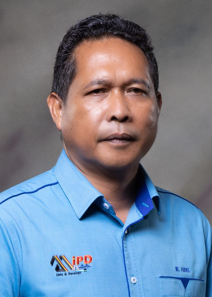
“Building bridges to connect one area to another areas is important to shorten travel time.
“The ministry tries to solve the infrastructure issues with building bridges as the transport bottleneck where the travel time will be shortened and cost effective in addition to making the cargo movement process smooth,” he told Sarawak Tribune.
The operational difference is particularly clear at former ferry crossings.
“Permanent bridges can be used around the clock rather than requiring motorists to wait for a ferry,” Aidel said.
At programme level, he listed five projects as completed: the Batang Rajang Bridge on the Jalan Pasi-Sibu/Tanjung Manis route, Batang Saribas Bridge, Batang Lupar 1 Bridge, Muara Lassa Bridge and Sungai Krian Bridge.
Another nine projects or related packages were listed as under construction, including the Batang Paloh, Batang Rambungan and Batang Igan bridges, the Bintulu-Jepak crossing at Kuala Kemena, and second crossings at Batang Saribas and Batang Lupar, alongside approach and trunk-road works.
The network, however, is not yet complete.
Aidel said the remaining gaps depend on projects still under construction, with most expected to be completed before the end of 2026.
For motorists, the difference between an incomplete network and a completed one may still be experienced one river at a time.
Why Batang Lupar 1 Bridge mattered
Among those rivers, Batang Lupar presented a challenge of a different scale.
Aqmarol said Batang Lupar 1 Bridge occupies a pivotal position within the Coastal Road Network because it addressed one of the programme’s biggest engineering and connectivity obstacles.
“For many years, crossing Batang Lupar river was regarded as one of the greatest obstacles to establishing a continuous coastal route due to the river’s width, engineering complexity, and the scale of investment required.
“Until that challenge could be resolved, there remained uncertainty over whether the Coastal Road alignment could be fully realised as originally envisioned.”
Its importance meant the bridge’s alignment and design underwent extensive evaluation.
“Various options were carefully assessed to balance engineering feasibility, constructability, long-term network performance, environmental considerations, land acquisition, and overall project cost.”
Its eventual completion, Aqmarol said, demonstrated that the Coastal Road alignment could be achieved.
“In many ways, Batang Lupar 1 Bridge became the project that transformed the Coastal Road Network from a long-term vision into an achievable reality.
“It is this pivotal role in completing the corridor that has led many to describe it as the ‘heartbeat’ of the Coastal Road Network.”
For Usah, the significance is measured much more simply.
He no longer has to plan his crossing around a ferry schedule.
“Now with the completion of the bridge, we can travel any time and it takes under 10 minutes to drive across the bridge,” he said.